


St. Andrews Voting District, Richland County, South Carolina
About
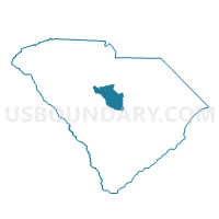
Outline

Summary
| Unique Area Identifier | 666583 |
| Name | St. Andrews Voting District |
| County | Richland County |
| State | South Carolina |
| Area (square miles) | 2.39 |
| Land Area (square miles) | 2.26 |
| Water Area (square miles) | 0.13 |
| % of Land Area | 94.63 |
| % of Water Area | 5.37 |
| Latitude of the Internal Point | 34.02366040 |
| Longtitude of the Internal Point | -81.08991800 |
Maps


Graphs
Select a template below for downloading or customizing gragh for St. Andrews Voting District, Richland County, South Carolina


Neighbors
Neighoring Voting District (by Name) Neighboring Voting District on the Map
- 021 Voting District, Lexington County, SC
- 030 Voting District, Lexington County, SC
- 041 Voting District, Lexington County, SC
- 052 Voting District, Lexington County, SC
- Kingswood Voting District, Richland County, SC
- Riverside Voting District, Richland County, SC
- Skyland Voting District, Richland County, SC
- Ward 30 Voting District, Richland County, SC
- Westminster Voting District, Richland County, SC
- Whitewell Voting District, Richland County, SC
Top 10 Neighboring County Subdivision (by Population) Neighboring County Subdivision on the Map
- Columbia CCD, Richland County, SC (168,103)
- Dutch Fork CCD, Richland County, SC (73,262)
- West Columbia-Cayce CCD, Lexington County, SC (61,546)
- Irmo CCD, Lexington County, SC (34,273)
Top 10 Neighboring Place (by Population) Neighboring Place on the Map
- Columbia city, SC (129,272)
- St. Andrews CDP, SC (20,493)
- Seven Oaks CDP, SC (15,144)
- West Columbia city, SC (14,988)
Top 10 Neighboring Unified School District (by Population) Neighboring Unified School District on the Map
- Richland School District 1, SC (201,528)
- Lexington School District 5, SC (91,018)
- Lexington School District 2, SC (63,322)
Top 10 Neighboring State Legislative District Lower Chamber (by Population) Neighboring State Legislative District Lower Chamber on the Map
- State House District 69, SC (42,328)
- State House District 72, SC (40,039)
- State House District 89, SC (33,501)
- State House District 73, SC (31,016)
Top 10 Neighboring State Legislative District Upper Chamber (by Population) Neighboring State Legislative District Upper Chamber on the Map
- State Senate District 19, SC (105,577)
- State Senate District 20, SC (103,494)
- State Senate District 26, SC (91,335)
Top 10 Neighboring 111th Congressional District (by Population) Neighboring 111th Congressional District on the Map
Top 10 Neighboring Census Tract (by Population) Neighboring Census Tract on the Map
- Census Tract 205.10, Lexington County, SC (4,684)
- Census Tract 104.07, Richland County, SC (4,284)
- Census Tract 104.03, Richland County, SC (3,875)
- Census Tract 205.06, Lexington County, SC (3,585)
- Census Tract 205.09, Lexington County, SC (3,468)
- Census Tract 104.11, Richland County, SC (3,174)
- Census Tract 104.12, Richland County, SC (3,159)
- Census Tract 6, Richland County, SC (2,332)
- Census Tract 205.08, Lexington County, SC (2,151)
- Census Tract 104.13, Richland County, SC (1,989)